Farm mapping
It all starts with your farm map
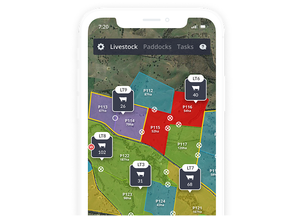
A hand-drawn map on the ute dashboard leaves too much to chance. AgriWebb gives every person on your team the same clear view of the land, even when there is no service.
.png)
A map of your farm that everyone can trust
A hand-drawn map on the ute dashboard leaves too much to chance. AgriWebb gives every person on your team the same clear view of the land, even when there is no service.
- Works offline in the paddock
- Shareable with your whole team
- Updates instantly across devices
.png)
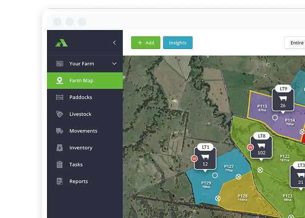
Practical tools for your paddocks
.png)
From paper maps to a living digital farm
It takes three simple steps. No complicated setup, just practical work that pays you back in time and clarity.

Drive, walk, or draw your boundaries and paddocks right on your phone or tablet.

Log grazing, moves, and treatments in seconds while you are still in the paddock.

Use live maps and records to plan grazing rotations and manage your team.
See every paddock's performance at a glance
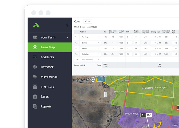
Visualise feed on offer, stocking rates, pasture growth, and grazing pressure across every paddock so your next move is always clear.
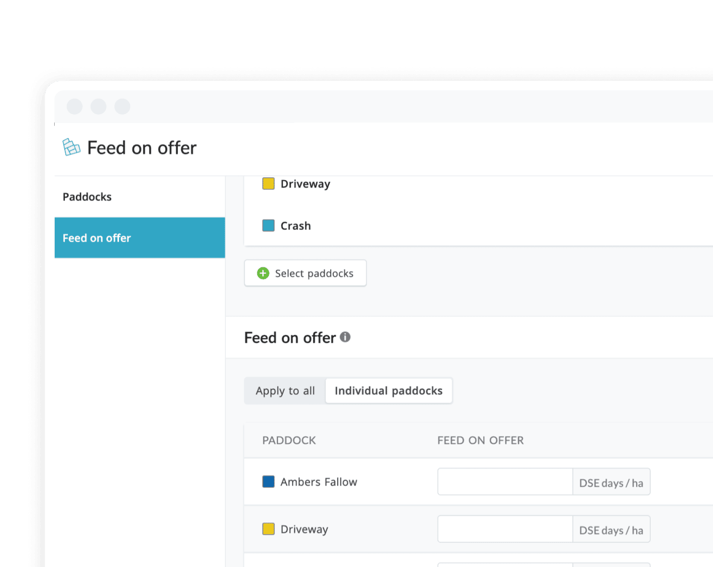
Know which paddocks are ready to go before you get to the gate
See feed available for stock (kg DM/ac, DSE days) or Stock Days in each paddock.
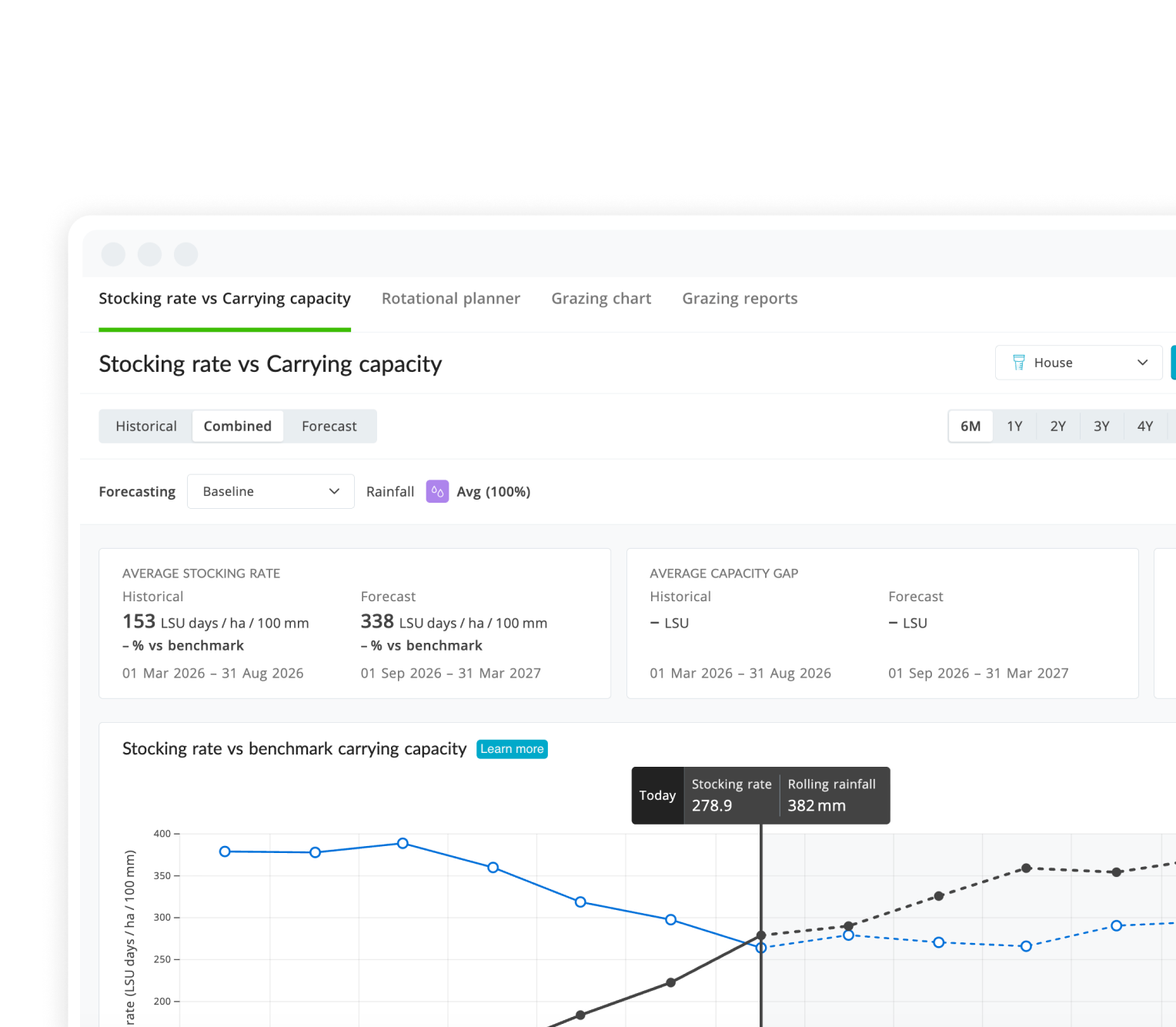
Know if you're overstocked before it costs you
View stocking rate (DSE/ac) in each paddock to keep grazing pressure in check.
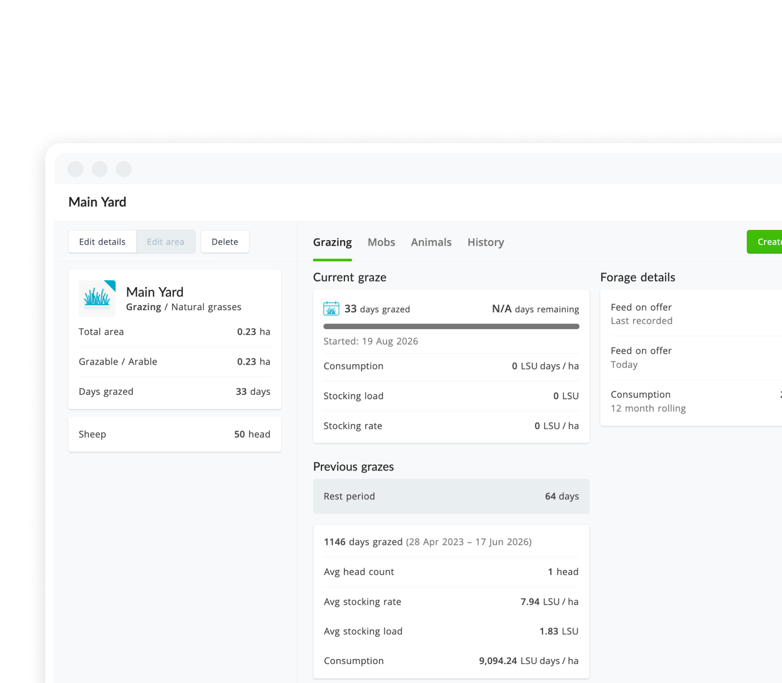
Know how many grazing days you've got left
Visualise grazing days remaining in each paddock at a glance, before feed runs short.
Know which paddocks have had the longest rest
See the number of days since stock were last in a paddock, at a glance.

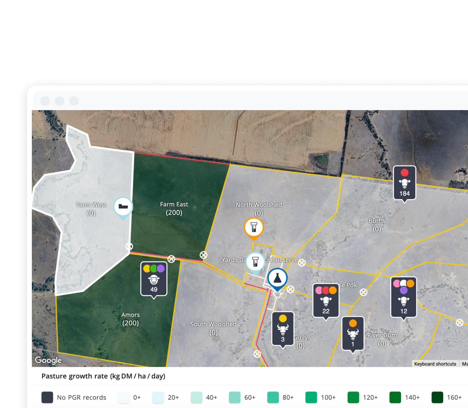
Know how fast your pasture is actually growing
View the daily growth of dry matter across each paddock, per acre.
Customer testimonials
FAQs
Farm mapping is about creating detailed, interactive digital maps of your land to improve operational management using GPS and other digital tools.
Field mapping improves how you use your land, allocate resources, manage livestock and more – all while giving you the tools to make better decisions for your operation.
Field mapping uses GPS data to create highly accurate visual representations of your farmland, with the ability to integrate real-time data updates.
Some examples of mapping include paddock usage mapping, infrastructure mapping, grazing patterns, resource allocation mapping and more.
A field survey collects data on land characteristics, infrastructure, environmental conditions and more to inform better decisions around farm management.
Yes. AgriWebb lets you import existing farm boundaries and data so there are no gaps in your records when you get started. Our team can also help you set up your map if you have digital boundary files already.
Farm mapping simplifies compliance by keeping accurate records and allowing for reporting on audits, biosecurity and regulatory requirements.
AgriWebb is the most comprehensive, easy-to-use farm mapping tool available. Designed to suit a wide range of operations, it offers powerful features and 24/7 support—no matter what kind of farm you manage.
See your farm clearly